Route 62 Distances
61,7km
76,4km
18km
29,7km
50,4km
34km
Montague
Barrydale
Ladismith
Zoar
Calitzdorp
Outshoorn
De Rust


The Klein Karoo has gone by many names. The Khoi called it “Xanga” which means “The valley between the hills” and later it evolved into the word “Cango”. “Kannaland” was also used by Europeans in the mid 1800s with the name derived from the shrub “Kanna” which is a prominent plant in the area. The Afrikaans name “Klein Karoo” comes from the words “Klein” meaning small and “Karoo” which comes from the Khoi word “Karus”which means dry, barren, thirsty land.
The beginning of a route
The Klein Karoo has attracted visitors for more than 300 years, from the early European explorers who were forging trade with the Khoi and San, who had lived in this beautiful arid valley for thousands of years. Then the settlers came and started farming, taking advantage of the rivers that run through this parched land. Towns developed rapidly when the world became obsessedwith ostrich feathers in the late 1800s and early 1900s.
At this stage, old wagon tracks were improved and began joining the settlements together at the initiative and expense of the local towns and villages. The Cape government stepped in later to improve the passes and poorts that were already in use and developed new routes over the mountain ranges that had isolated thisvalley from the outside world. Tourism had begun in earnest back in the late 1800s with the discovery of Cango Caves which, at this stage, was the top tourist attraction in South Africa.
It was only after the advent of the 1935 National Roads Act that South Africa started taking their road infrastructure seriously which, at this point, was far behind the developing world with most ofthem still dust and gravel roads and most not exceeding 40km. This delay of road infrastructure was caused mainly by the total stranglehold of the railways which dominated transportation and did not want to lose market share. The American road letter and numbering system was adopted and roads were given new status: ‘N’ for national roads, ‘M’ for main roads, ‘R’ for regionalroads and, thus, Route 62 (R62) was born in name. National government now worked with provincial and regional government to improve the roads.
It was only in 1978 that the R62 was tarred and the new Huisrivier Pass, built in 1966, truly connected the Calitzdorp side of the Klein Karoo to the western part of this region.R62, as a tourist destination, took off in the post-apartheid era (1995) when many foreign tourists flocked to South Africa and tour operators saw the wisdom of including R62 as part of their Garden Route tour, thus including Cango Caves and the ostrich farms as a starting point.


Ostrich feathers were all the rage in the late 1800s and early 1900s which made the Klein Karoo very wealthy


Cogmanskloof, the gateway to the Klein Karoo and Route 62
Getting to Route 62
Most visitors to the R62 will be departing from Cape Town, which is a spectacular journey in itself. The most direct route, at a distance of 173 km, would be via the N1 to Paarl, through the tolled 3.9 km Huguenot Tunnel which opened in 1988. The more scenic free route would be to go over the mountain via the 1948 Du Toitskloof pass. Both routes display the breathtaking sceneryof the inner Du Toitskloof valley and the broad Breede River valley.

Today, the R62 is marketed as the longest wine route in the world, stretching from before Montagu all the way to Gqeberha (Port Elizabeth) and is atourist destination in itself, just like the famous Route 66 in America which was the inspiration for the R62.This guide, as you will note, does not cover the whole ofthe R62 tourist route as it is just too long for one guide to do it justice, so it sticks mainly to the original road that is designated as the R62 starting just before Cogmanskloof and ending at Oudtshoorn and its surrounding areas.
At Worcester, take the R43 into town until you reach Hoog Straat. Turn left and drive for about 1.5 km till you reach the R60 on your right. This road will take you out of Worcester to Robertson, known as the town of wine and roses, 47 km away. Pass through Robertson, keeping on the R60 until you reach Ashton,the fruit canning factory of South Africa, 19 km away. After leaving Ashton, you depart from the R60 and drive straight through the Langeberg Mountain via Cogmanskloof, the gateway to the R62 and the Klein Karoo.
The land between mountains
Before undertaking your journey on the R62, it is of interest to know what formed this land, as this is the canvas that the history of the Klein Karoo is painted on. Today, we see a broad valley of about 50 km wide and 290 km long, flanked by two massive mountain ranges. The story of how this valley and the mountain ranges formed goes back to the creation of the super continent,Pangaea, 280-235 million years ago, when South America, Africa and the Falklands Plateau collided due to continental drift.
When the Falklands Plateau smashed into Africa from the south, it buckled, crumpled and bent horizontal layers of rock which had started forming in the ancient Agulhas Sea. As well as contorting the once horizontal rock strata, it also formed the massive parallel fold mountain ranges we see today. While these sandstone mountains were slowly forming, the Klein Karoo valley was under shallow water fed by numerous rivers that brought sediments that compacted into layers over time.

Ostrich racing has been around since the beginning of the ostrich industry but this practise stopped in the mid 2010s as it was seen as unethical towards animals
Because the water flow was slow, fine-grained particles managed to settle on the bottom, forming the mudstones and shales we see today. Most ofthe western Klein Karoo valley is made up of what we now call Bokkeveld shale. There are three other notable rock formations of interest, that can also be seen in the valley, each depicting another geological event.Rooikrans (Redstone Hills)was formed after the great lava outpourings in the Karoo 180 million years ago, which brought large-grained sands, stones andpebbles, due to high energy water flow, into the valley.
These deposits solidified 145-66 million years ago into a conglomerate rock. The second rock formation is the Kirkwood formation which is found around Oudtshoorn. This fine-grained sandstone/mudstone was deposited under fluvial conditions in the time of dinosaurs, but what it is most known for are the beautifulmasonry stonework of the buildings and feather palaces in Oudtshoorn. The last notable formation of the Klein Karoo is the Cango Group.
A 300 km-long fault line along the southern edge of the Swartberg Mountains formed during the break up of Pangaea. This exposed and uplifted much older rock under the Cape Supergroup. Forming part of this formation are the exposedrock cliffs seen in Schoemanspoort on the way to Cango Caves and also the limestone marine deposits of the Cango Cave system itself.
By 1729, the Europeans were no longer just visiting but were setting up farms, first for cattle grazing but, with the arid terrain, they moved over to vegetable and fruit farming on the banks of the rivers flowing through this dry land. The establishment of settlements followed with central hubs where the farmers could meet for religiousgatherings (nagmal) and commerce. Churches were built to cement their local authority. Most of these towns were established using the old Attaqua Kloof Pass and Platte Kloof Pass.
A very brief history
In 1689, the Khoi chief, Hykon of the Inkgua tribe, who resided in the Klein Karoo, requested a trade visit by the European settlers at the Cape who had been there for 37 years. This request was granted by Simon van der Stel who sent Ensign Schrijver and 21 men. The route taken followed the old ‘Kaapse Wagenweg’ up the east coast to near Mossel Bay where they used an oldKhoi migration path called the Attaqua Kloof.

As more settlers established themselves, additional passes and poorts were built to give local farmers closer routes to get their produce to market through the Langeberg. At the same time, coastaltowns like George could not get through the Outeniqua forests and gorges so these passes and ports enabled them to make their way round. In the north, poorts and passes started to appear in the Swartberg as Europeans began to settle in the Groot Karoo and needed shorter routes to the coast.
Tobacco was introduced in 1845, making it one of the first commercial growing areas in South Africa and thelargest for its time. The single biggest event to shape the Klein Karoo and made it one of the wealthiest regions of South Africa was the voracious ostrich feather fashion trend from 1865 to1870. It reappeared in 1900 to 1914. What made this region the world capital of the ostrich feather industry was the ability to get ostriches to breed in captivity and the introduction of thenewly invented incubator which increased chick survival rates.


Oudshoorn also became an important railway junction, starting in the late 1800s, that connected Gorge, Gqeberha and the hinterland. All was not boom for the inhabitants of the region after the collapse of the feather industry. Milliners became paupers and extended droughts, floods and epidemics took their toll.
In recent times, the area has revived itself as an important tourist destination as part of the Garden Route loop, as well as boasting the longest wine route in the world, Cango Caves and many private game reserves which are in a malaria-free zone with some home to the Big Five African animals.
Route 62 Road Trip
Cogmanskloof
This has to be one of the most spectacular gateways to any region in the world with the towering Langeberg Mountain (Long Mountain) flanking a narrow passage created by the Kingna River. Geologists speculate that the river was here long before the rising mountain range but kept pace through erosion. This gap through the mountain is considered a poort and not a pass as ittends to hug the valley floor with very little gradient. A pass has a much higher gradient ratio and utilises higher ground on either side of the canyon and can cross over ridge lines and mountain tops. Cogmanskloof was first used as a footpath by the Khoi and, thus, was named after the local clan of the area in 1701.
European settlers also used it as a footpath until ThomasBain’s developed the first road in 1873 as there were numerous impassable sections for wagons to travel due to high waters and flooding.
The new road one drives on today was built in 1953 and was upgraded in 2025. The highlights in this kloof are the historical unlined tunnel, the remains of Bain’s old road which can be seen on the right just before the tunnel, the old British fort,‘Sidney Fort’, built on Kalkoenkrans to keep the Boers out of the Cape during the Second Anglo-Boer War and the superb examples of folded rock that are now vertically positioned. It was these rocks that made Montagu a rock climbing mecca with its first traditional climb in 1971 and, later, the home of sports climbing in South Africa starting from the early 1980s.
Montagu
After leaving Cogmanskloof, you enter the beautiful colonial town of Montagu, the oldest European settlement in the Klein Karoo. In 1744, the first farm was established via the Koo Valley by the widow van der Merwe. In 1850, the farm, De Uytvlugt, was sub-divided to create a village. This made it one of the very few towns not established around a church (kerkdorp).

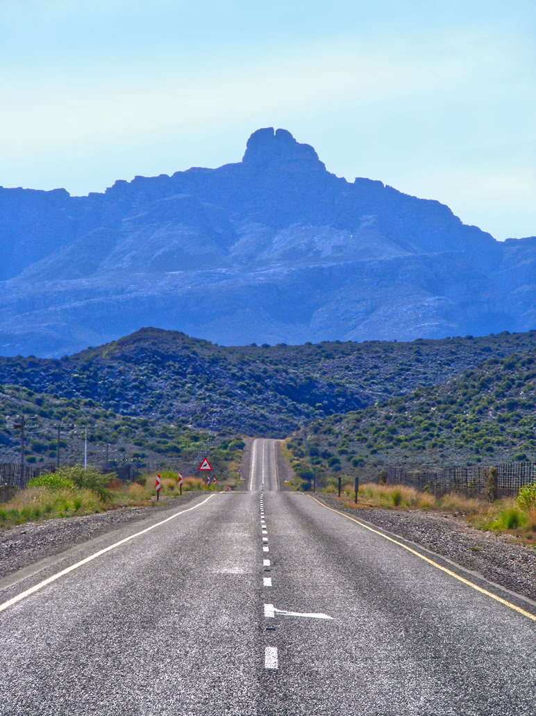
Towerkop, the most prominent peak on Route 62


The hamlet of Barrydale with the Tradouw Pass behind

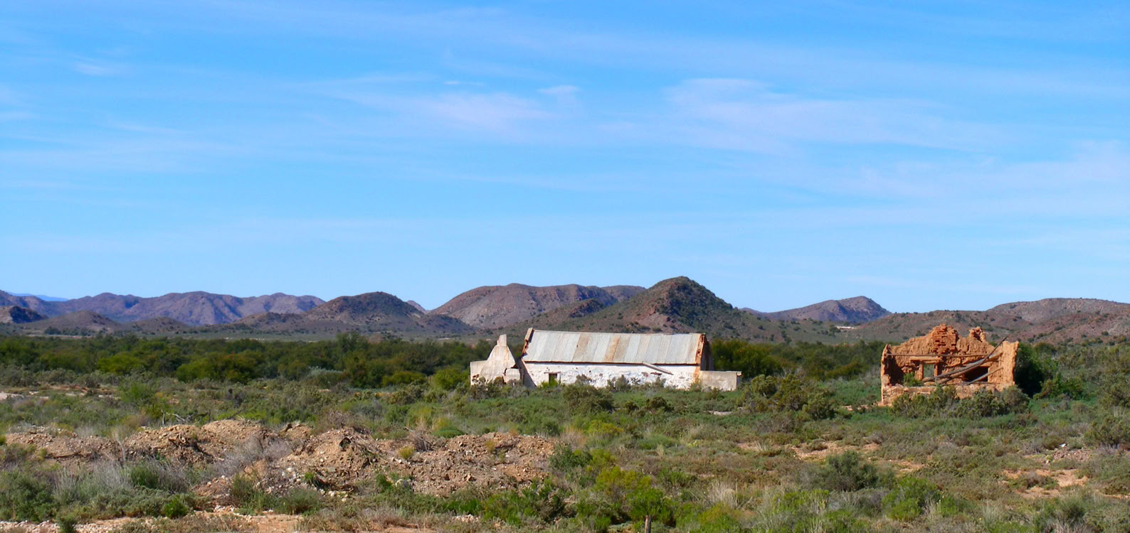
Beautiful arid landscape between Barrydale and Ladismith


Calitzdorp, the port wine capital of South Africa


At this time, farmers moved away from cattle grazing to crop growing to take advantage of the fertile valley fed by the Kingnaand Keisie Rivers. The town was known as Agter de Cogmans Kloof until it was renamed in 1851 after John Montagu, the Colonial Secretary at the Cape. Today, you will see a town that is filled with beautiful historical buildings showcasing Cape Dutch, Victorian and Georgian architecture.
Along with its first and main attraction, the hot springs, which acquired its first bath house in1873, the town offers many outdoor activities such as rock climbing, hiking, biking, golf, restaurants, art galleries, wine tours, birding, game drives, a museum, San rock art and historical walks and rides.
When leaving Montagu towards Barrydale, you will notice a slow climb out of the Montagu catchment basin area where you cross a watershed at the Op de Tradouw Pass. Fromhere, you follow the Tradouwrivier down to the Barrydale catchment area where the river breaches the Langeberg mountain through the Tradouw Pass.
Barrydale & Tradouw Pass
This was the second logical place for a town to be established on today’s R62 as it lies in a bowl funnelling the surrounding rivers through the Langeberge via the Tradouw gorge and also gave the settlers faster access to markets to Cape Town through this pass at a later date. This kerkdorp was built, in part, on the farm ‘Tradouwshoek’ (mid 1700s). Even though this settlement wasfirst established via Cogmanskloof and Platte Kloof, it truly took off once a decent wagon road was built through the pass in 1873 by Thomas Bain.
The town is said to be named after Joseph Barry who was the most dominating businessman in the Klein Karoo and Overberg because of his shipping enterprise on the Breede River and his own private printed money. It was 8 yearsafter Barry’s death that the Southey’s Pass was opened but the locals preferred the original name ‘Tradouw’ (meaning “the women’s poort” in Khoi) and the town grew from a farmer’s hub to a residential town.
Today, most through-visitors usually stop at the iconic restaurants on the R62 above the town but a quick detour into the town will reveal quaint streets with a Britishcolonial feel, interesting shops, lodges, restaurants, art galleries, a proud 1908 church and one of the best second-hand bookshops in the Western Cape. Along with these, a visit to the Barrydale Hand Weavers factory should be a must.
Ladismith
After leaving the Barrydale valley, you cross over a ridge line defining another water catchment area with all the rivers now draining east. The road now crosses the Klein Karoo valley and is the longest part of the R62 without settlements. The highlight of this section of the road is the arid, yet beautiful, landscape of the rounded Bokkeveld shale hills contrasted against the giantrugged quartzite mountains of the Swartberg range, and the freestanding Warmwaterberg and Touwesberg, the leftovers of the Cape fold belt. Ronnie’s Sex Shop, 26 km outside Barrydale, is a popular pitstop with an interesting backstory, a prank that put it on the map.


The NG Kerk Kangovalleie at Schoemanshoek
Ladismith is reached in less than an hour with the iconic backdrop of the Towerkop Peak. There are twointeresting tales about this peak. Firstly, it is thought that the name comes from a legend that a witch was flying over the mountain and the peak got in the way so she split the mountain in two so she could pass through it. The second but verified story is about a young local man, Gustav Nefdt, who was the first person to climbTowerkop in 1885. He had solo-climbed the routewith no rope and, at the time, it could be considered one of the hardest technical rock climbing routes in the world.
It took the Mountain Club of South Africa 46 years to repeat his route.Ladismith is a very interesting town with many stories. In 1770, it was the most northern outpost of the Cape Colony; it became independent from Dutch rule for 4 months in 1795alongside the Swellendam revolt. By 1850, the farmers in the area were meeting in Oom Balters Kloppers’ shed for church. Land was purchased from him which became ‘Lady Smith’ (named after Sir Harry Smith’s wife). The name changed to Ladismith in 1879 to stop the confusion with the same name used in then-Natal. Because it is considered a kerkdorp (the focal point of thetown), the old church was replaced with a new spectacular church, built by the master church builder, Carl Otto Hager, in a Cape Gothic style. He constructed the new church around and over the old church so as to not disrupt services and disassembled the old church inside.

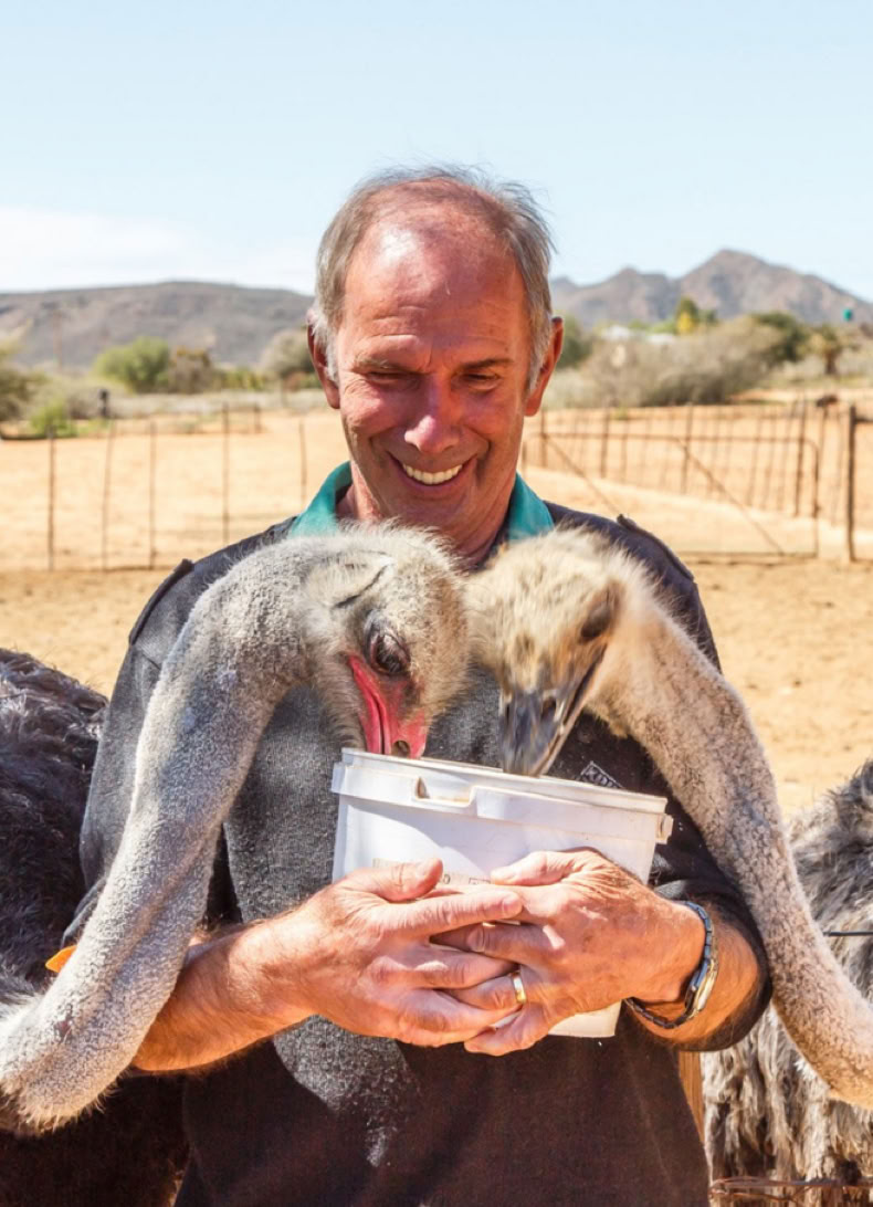
Hand feeding ostriches at Highgate

Meerkat


The red hills of Rooikrans
Ladismith was also the first and only town east of Callitzdorp to get a railway line in 1925 but, in 1981, agreat flood destroyed a large portion of the line which was never replaced. Today, this little town is worth a visit and not only as a pit-stop through to the next town. From many get-away spots, outdoor activities, cellar visits, to taking in the unique architecture of the town which has acquired its own name: ‘Ladismith style’.
Calitzdorp
On leaving Ladismith, you pass the turn off to Seweweekspoort which is an experience in itself, but closer to the R62 is Zoar, the oldest mission town in the Klein Karoo (1817). Close by is Amalienstein (1853), another mission station. These mission stations served the indigenous population and ex-slaves who had been forced off open land mainly by the ‘Caledon Code’ of 1809.Back on the R62, your journey takes you through the Huisrivier Pass which was the key to the establishment of the R62.
The first pass was built in 1897 and can still be traced on the hillside above the new 1996 tarred road. This pass drops you down a few hundred metres to the next geological level of the Klein Karoo. Calitzdorp, the port wine capital of South Africa, is reached atthe bottom of the pass. This area, on the junction of two rivers, is fertile compared to the surrounding arid Klein Karoo landscape. In 1757, J Pretorius settled in this area and later, in 1821, so did JJ and MC Calitz.
With The Calitz’ ever-growing family, the town became known as ‘Calitz Dorp’. The settlement became a kerkdorp in 1873. Over the years, the town grew mainly on the back offarming wine, brandy, tobacco, wheat, vegetables and fruit. The town had its fair share of booms and busts; the booms included the ostrich feather boom and the busts as a result of excessive drought and epidemics. A railway line was built in 1924 to Oudtshoorn to help get the town back on its feet. Today, it is still a farming area but has attracted retirees and tourists withits beautiful setting, vernacular architecture, wine tasting and slow pace of life.
Oudtshoorn
15 km after leaving Calitzdorp on the R62, keep your eyes on the left for the Rooikrans (Redstone Hills). It is worth driving down this gravel road to get up close to one of the finest conglomerate rock formations in South Africa. Back on the R62, you pass De Hoop (1908) with its conspicuously oversized church for its small community. This settlement was founded on theostrich feather boom. Another 15 km on from De Hoop, you arrive at the capital of the Klein Karoo.
This is not the oldest settlement in the valley, but it gained the most importance, being the major crossroad and thoroughfare from the Cape to the north. It also became the hub of the ostrich feather empire, the commercial centre in the region and also an important tourismdestination as far back as the 1800s with the discovery of the finest cave system in Africa. The town was first called Hartebeestenfontein where a church was founded in 1839.
The name ‘Oudtshoorn’ (1849) either came from the newly appointed Cape governor in 1772 (he died on the voyage on the way to the Cape) or after the wife of the firstCommissioner of George (which this region fell under). Today, one can visit the many attractions that hark back to its golden years when it was one of the richest towns in South Africa, from the ostrich palaces, historical public buildings, ostrich show farms, numerous passes and poorts and Cango Caves, still its number one attraction.
Added to these old attractions, many moretourism-related businesses over the years have come on board to enrich visitors and add variety. These have come mainly in the form of animal encounters, game reserves, wine routes and outdoor pursuits. Oudtshoorn is well placed for day trips to the surrounding areas such as Cango, Rust en Vrede Waterfall and Meiringspoort.


The jewel of the Klein Karoo, the spectacular Cango Caves are the biggest show caves in Africa


The Art Nouveau Mimosa Lodge in Oudtshoorn is one of the fine examples of an Ostrich Palace built using local Kirkwood stone
De Rust
De Rust (‘The Rest’), on the N12, became a favourite place to ‘outspan’ near a mountain spring. It was established in 1900, making it the youngest town in the Klein Karoo, on a portion of the farm belonging toPetrus JohannesMeiring. Although it is small, De Rust is a convenient travel base. From here you can do all manner of day trips to places like Prince Albert, Oudtshoorn, Klaarstroom, the Swartberg Pass and beyond. There are various walking and cycling trails as well as attractions such as vineyards and olive farms.It is well known for its Victorian architecture.


Jackal Buzzard. The Klein Karoo is a bird-watching paradise


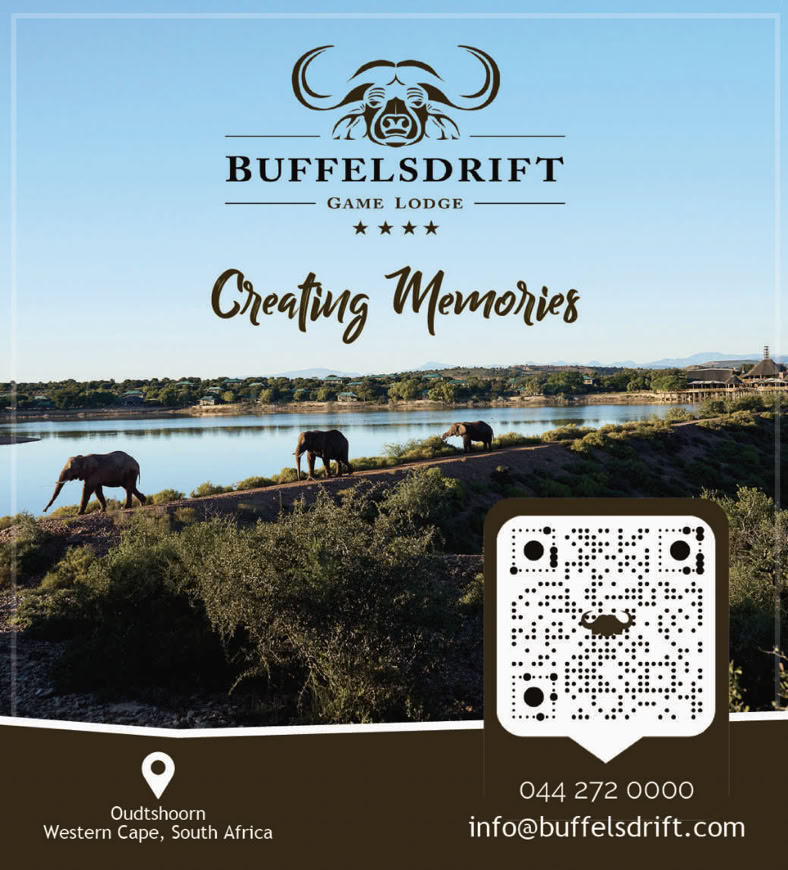
Elephant at Buffelsdrift

Giraffe at Buffelsdrift

Lion at Buffelsdrift
The Klein Karoo has the highest concentration of mountain passes in South Africa. Most of these passes can be navigated using a normal car on tarred or well-maintained gravel roads.

Cogmanskloof Pass
This 6.5 km pass, technically a poort (as it follows the riverbed), is found between Ashton and Montagu. The pass, with hardly any gradient, is named after a Khoi chiefdom. A meaningful road was built by Thomas Bain between 1873-1877. The highlights of this tar road pass are the spectacular folded rock formations, world renowned sports climbing area, the historical unlined tunnel and the 1899 British fort.

Tradouw Pass
This pass derives its name from the Khoi, meaning ‘footpath of the women’. The orginal pass from Barrydale to Suurbraak was built by Thomas Bain in 1869 -1873 and has been revamped as a tar road. It is a 16 km breathtaking pass with an altitude range of 219 m. The pass was commissioned to service the farmers of the Klein Karoo with a direct route to Port Beaufort on the Breede River where Joseph Barry’s shipping industry could take their products directly to market in Cape Town.

Seweweekspoort
This 17 km pass through the Swartberg Mountain connects the Klein Karoo to the Groot Karoo and was constructed by Adam de Smidt from 1859 -1862. This magnificent narrow gravel road pass, with its towering folded cliff faces, multiple river crossings and tight gorge, can be driven using a normal car today. It is said that this pass is named after Reverend Louis Zerwick who served at the Zoar Mission Station close to Ladismith or after the seven-week's fern that grows within its gorge.
Swartberg Pass
It is asserted that this was Thomas Bain's final and best piece of road building, fulfilling a need, in the late 1800s, for a direct route from the Karoo through Oudtshoorn and onto Mossel Bay. He built this pass between 1883-1886 with a gradient of 1 to 8 through tight gorges flanked by massive cliff faces and with impressive hairpin bends and switchbacks to gain the summit. The 23,8 km gravel-surfaced pass today follows Bain’s original line and can be driven using a normal car.

Tradouw Pass
This pass derives its name from the Khoi, meaning ‘footpath of the women’. The orginal pass from Barrydale to Suurbraak was built by Thomas Bain in 1869 -1873 and has been revamped as a tar road. It is a 16 km breathtaking pass with an altitude range of 219 m. The pass was commissioned to service the farmers of the Klein Karoo with a direct route to Port Beaufort on the Breede River where Joseph Barry’s shipping industry could take their products directly to market in Cape Town.
LANGEBERG & OUTENIQUA MOUNTAINS
Cogmanskloof Pass • Tradouw Pass • Garcia’s Pass • Cloete’s Pass & Jan Muller Pass • Robinson Pass • Outeniqua Pass • Montagu Pass
SWARTBERG MOUNTAIN
Seweweekspoort • Swartberg Pass • Meiringspoort
PAARDENBERG
Huisrivierpas


Notes
All information is given in good faith but, as times and facilities may change, the author and publisher cannot be held responsible for any inaccuracies. Proofreading: Shelley Woode-Smith • Citations available on request • Thanks to Kate Woode-Smith for the road trip, advise and some of the photographs. © Richard Smith • Gateway Guides
Edition 1 • 2025

DISTRIBUTION PARTNER
www.gatewayguides.co.za
All Rights Reserved
Contact us if you wish to engage with any of our products

IN ASSOCIATION WITH